In a slight interruption to usual service, this is a post about walking. Normal stately home commentary will resume next week.
For the first time in too long, I went for a proper walk. I’ve been kept at home partly by being too busy with stately homes, partly by the weather. And also because, ever since The Hard Way came out, I’ve been lacking a path forward and so didn't know where to go.
This was both a literal and metaphysical problem; if I was not tracing an ancient route, I could go anywhere, but then why go at all. Until this week the weather insisted and, crucially, I managed to turn two sets of vague questions about ancient trackways into a starting point. So I went there. And what’s amusing and ironic about this place is that it was only a 20 minute drive from my house.
The walk was a loop which started and finished at Horningsham (which is also the estate village for Longleat, stately home fact fans) but taking in a high chalk ridge. This was where I’d guestimated the start of a track which links up with a Roman Road and heads on a ridge down to Wilton and Salisbury, and so on to Poole. All of which looked interesting.
The second question was one that has been bothering me for a long time, which is could I find other ancient trackways which run between the two main paths of the Ridgeway and the Harrow Way.
This is not just an abstract question. Where I was walking sits equidistant between where the Ridgeway comes down from Salisbury plain at the top right hand corner of that map and where the Harrow Way crosses from White Sheet Hill to Kilmington. I’ve also noticed that a couple of the roads I use around there to cycle on (like the one which runs east from Maiden Bradley to Kilmington and therefore the Harrow Way) are very much ridgeways. So is this a kind of Neolithic Spaghetti Junction? The answer to this question is of course, we’ll never know. But we might have some fun finding out.
The ridge I was heading for is right in the middle of the map and it’s called Cold Kitchen Hill. I had no particular agenda apart from it seemed to be where you might head if you were going from the Harrow Way via Maiden Bradley towards that ridgeway towards Wilton. It was a start.
This walk, as is the case with many I do, was a story in three acts. The problem with all chalk ridges is that you begin the day by having get to them, which means that you begin by climbing and in the case of this walk, on valley trackways which are completely sodden with dew. And so act one was me, with half a lake in my walking boots, crossly wondering whether any of this was worth it.
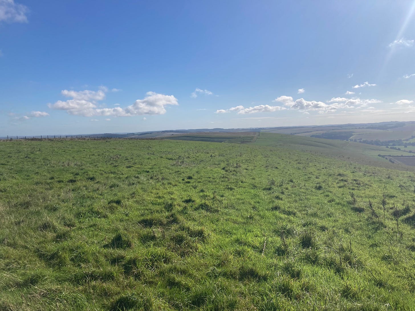
Act two takes place on the ridge, where everything suddenly gets much better. There is a reason why old roads follow ridges, usually on the southern side, and that’s because they stay dry. So dry that I took a picture of the white chalk line of the path climbing up, right at the start
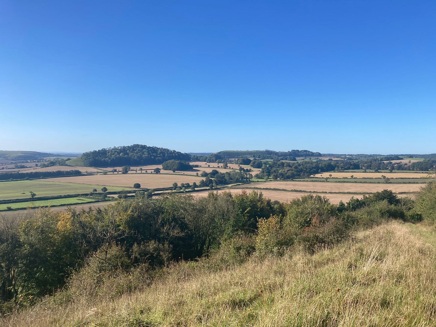
What I had not foreseen is how much of a ridge Cold Kitchen Hill really is. The views each side stretched for miles: out to Whitesheet Hill and the Harrow Way, miles north towards Bath and, later on, over towards Salisbury Plain.
Generally, the ridge was a deserted and unmarked place. I met two hikers from Ottawa, and two riders and saw no one else up there. There’s a sense that a hedged road once rand down the middle of the ridge, but that’s all overgrown now and the path runs alongside. Not a place with any purpose these days.
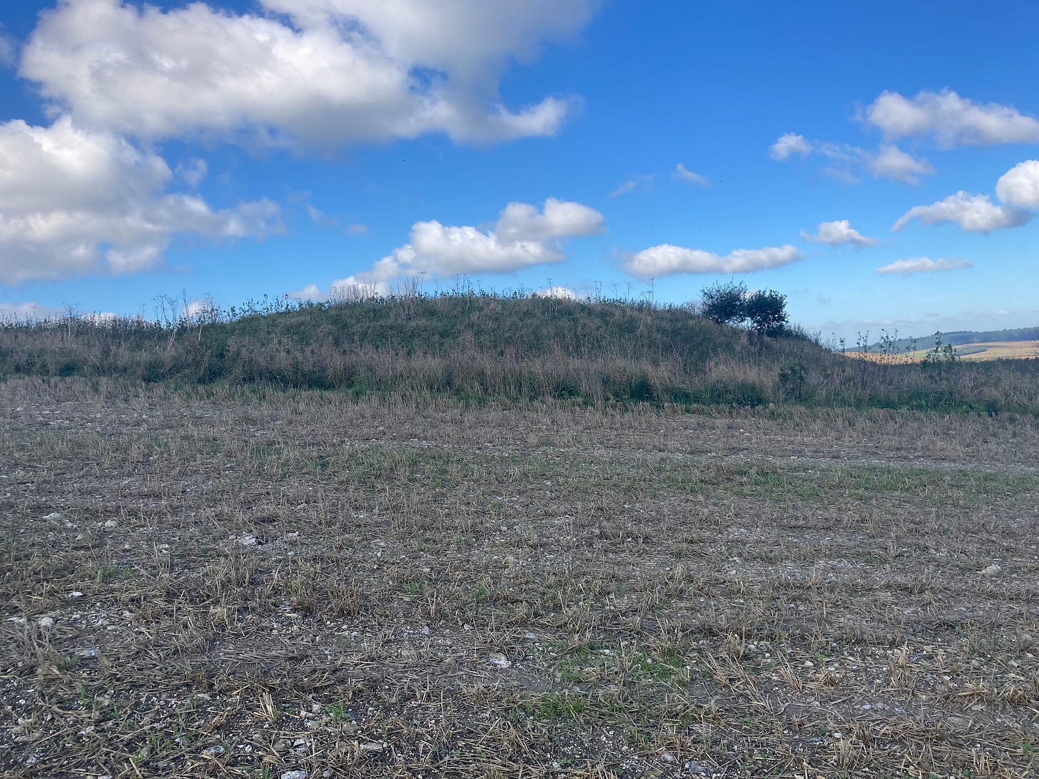
But there was also a sense that this had once been a route that mattered. Squint at the map, and you’ll see two tumuli marked on the hill. They might be signalling to people down in the valley, or they might be markers for the path. Then, further along is a little known but very well-preserved long barrow, which even preserves its surrounding ditches. I did not take a very good picture of it.
At this point I am still in Act Two of the walk in which the weather is lovely, my legs don’t ache, I am happily walking on an old road and I feel as if I could go on forever.
But in this lurks the germ of Act Three, because I went on so far that I forgot I hadn’t brought lunch and completely underestimated how long it would take me to get back to the car, and how much of this would take place on tarmac. I will spare you the details but it was a slow underfed trudge and I was not happy.
The fun returned when I was back at home, wondering about where I had been. It turned out that I had been walking past a lot of history which sat under the skin of the grass.
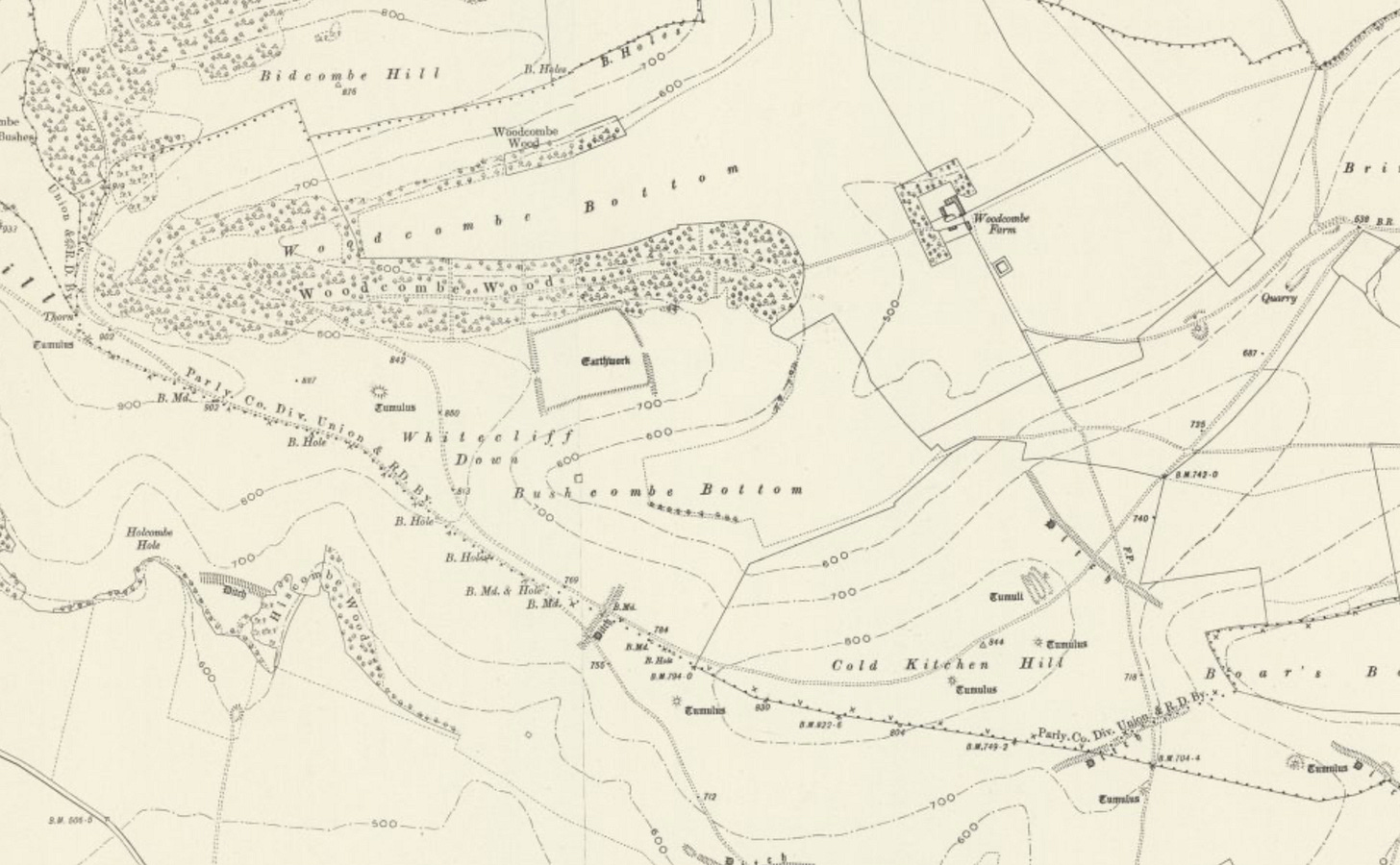
Here’s the hill as seen on the OS map from 1901. The track may not be so visible, but there’s clearly something going on here. To start with, a major set of boundaries follow the line of the track. As far as I know, there isn’t any direct work linking up old boundaries with ancient trackways (if I am wrong, please do point me at it) but if I tell you that the Ridgeway coincides with a large stretch of the old boundary of Oxfordshire, this gives you a sense of the kinds of continuities which might be encoded in the landscape.
Secondly, look at the three ditches which cross the path. Sometimes these are known as Grims’ Ditches in various places and - guess what - no one knows what they are. Perhaps Anglo Saxon boundary markers, perhaps earlier. But what they do, all over the place, is block roads. Or perhaps act as customs points, or checkpoints or al the other kinds of things that people do when roads cross boundaries. But to me they are another hint that this is an old track. Note also the nice way that they enclose the neatly-drawn long barrow. This may or may not be a coincidence.
But the real entertainment is in the middle in that large square Earthwork. Which, it turns out, is a Roman temple, and an Iron Age Temple and a Dark Earth Midden. The first two are both self-explanatory and exciting, and suggest that Things Were Happening Up Here. As does the third - it just needs a bit more context.
Giant middens like this - midden being archaeologist speak for rubbish dump - are huge areas of unusually dark soil, bones and pottery, with the soil suggesting a large number of animals. They date from the early Iron Age and most likely are ritual sites, with the suggestion that large numbers of people and animals came together for feasting, over several generations. Imagine a cross between the Glastonbury Festival and the Bath and West Show in a time before hardstanding, plastic sheeting and when metal objects were as rare and valuable as mobile phones and so unlikely to be dropped and forgotten.
The name Cold Kitchen apparently comes from the Celtic Col Cruachan, meaning Hill of the Wizard, suggesting that this was a special place long before any Italians came calling. So the Romans were just building in an already sacred space, as they liked to do.
What’s also interesting is that, when you read about the Roman Temple, it apparently sat at the crossing of two Roman Roads. Which are very much not what is visible up on Cold Kitchen Hill. Which then begs one very important question: were these roads just reusing older trackways?
It’s not the first time I’ve had this thought - why are the Iron Age sites of Badbury Rings and Old Sarum major Roman junctions? And it turns out I am not alone either. Even the Victoria County History1 thinks that the Roman Road is following part of an older path.
I’m telling you this partly because it’s interesting, I hope, in itself. But it’s also a reminder of how interesting places can be when looked at through the lens of a topophile2. Almost every piece of England has been used and altered, worshipped and abandoned, walked over and considered many times before we ever get there. And even in the places we take for granted - in this case just fifteen minutes drive from my house - there is a whole landscape of history waiting to be read from the ground. If only we can be bothered to look.
If you liked this post, you may well also like my book The Hard Way, which came out earlier this year and can be bought in all good bookshops. If your bookshop is less than optimal, they can order it.
If, however, you are impatient with this and want me to get back to stately homes, you can show this by pledging for a copy of Burning Down The House at Unbound because the sooner it is funded, the more time I can spend on actually writing it. Thank you.
https://www.history.ac.uk/sites/default/files/file-uploads/2019-07/brixton_deverill_introduction_0.pdf They take their information from OGS Crawford’s Wessex From The Air which has a lovely picture of the road surfing the downs in 1924.
The term was coined by the poet W. H. Auden in an introduction to the collected works of John Betjeman. These were being published in America, so he had a lot of explaining to do. The literal meaning of topophile is someone who loves places, but for Auden this attachment is to history and culture as much as to landscape.


I did enjoy The Hard Way very much - I’m a Wiltshire girl (living in Scotland) my mum was from Tisbury and my dad grew up in Quidhampton - so I know some of the area you speak of… I do like hearing about the old map stuff. Fab.